Uploads by Joeylad
Jump to navigation
Jump to search
This special page shows all uploaded files.

| Date | Name | Thumbnail | Size | Description | Versions |
|---|---|---|---|---|---|
| 09:52, May 26, 2026 | County Durham Wards.svg.png (file) |  |
246 kilobytes | Description: English: The Wards of County Durham By Hogweard, CC BY 3.0 <https://creativecommons.org/licenses/by-sa/3.0/deed.en>, via Wikimedia Commons Source: https://commons.wikimedia.org/wiki/File:County_Durham_Wards.svg This file is licensed und... | 1 |
| 10:44, August 14, 2025 | Ridings of Lindsey - Lincolnshire.svg.png (file) |  |
31 kilobytes | Description: The Ridings of Lindsey in Lincolnshire Source: https://commons.wikimedia.org/wiki/File:Ridings_of_Lindsey_-_Lincolnshire.svg Public domain {{publicdomain}} Category:United Kingdom | 1 |
| 15:24, July 30, 2025 | CardiffMontage1 (1).jpg (file) |  |
408 kilobytes | Description: English: Montage featuring Cardiff Castle, the Welsh National War Memorial, central Cardiff, the Senedd, Cardiff Bay and Alliance By MichiganCharms, CC BY 3.0 <https://creativecommons.org/licenses/by-sa/3.0/deed.en>, via Wikimedia Commons... | 1 |
| 12:49, July 29, 2025 | Bedfordshire Brit Isles Sect 5.svg.png (file) |  |
106 kilobytes | Description: Bedfordshire location map Source: https://commons.wikimedia.org/wiki/File:Bedfordshire_Brit_Isles_Sect_5.svg Public domain {{publicdomain}} Category:United Kingdom | 1 |
| 15:41, May 14, 2025 | Crowthorne and Minety Hundred - Gloucestershire.svg.png (file) |  |
228 kilobytes | Description: Crowthorne and Minety Hundred in Gloucestershire By Hogweard, CC BY 3.0 <https://creativecommons.org/licenses/by/3.0>, via Wikimedia Commons Source: https://commons.wikimedia.org/wiki/File:Crowthorne_and_Minety_Hundred_-_Gloucestershire.... | 1 |
| 15:26, May 14, 2025 | Church of St John the Baptist, Cirencester, Gloucestershire - geograph.org.uk - 3492489.jpg (file) |  |
587 kilobytes | Description: English: Church of St John the Baptist, Cirencester, Gloucestershire By Christine Matthews / Church of St John the Baptist, Cirencester, Gloucestershire Source: https://commons.wikimedia.org/wiki/File:Church_of_St_John_the_Baptist,_Cir... | 1 |
| 08:05, May 14, 2025 | Stratford On Avon historic map 1902.jpg (file) |  |
522 kilobytes | Description: Stratford on Avon: A bird’s-eye view of Stratford-on-Avon made by J. Ross Brown in or about 1908. It is not to scale. Source: https://commons.wikimedia.org/wiki/File:Stratford_On_Avon_historic_map_1902.jpg {{public domain}} [[Categor... | 1 |
| 23:06, May 13, 2025 | Timbered buildings in High Street, Stratford-Upon-Avon - geograph.org.uk - 1113191.jpg (file) |  |
79 kilobytes | Description: English: Timbered buildings in High Street, Stratford-Upon-Avon The Hathaway Tea Rooms, Celtic Woollens and the Chemist were originally one house with gables all along. Built ca. 1600, restored 1920s. Now listed in two groups, the further... | 1 |
| 12:55, May 1, 2025 | Gloucestershire Brit Isles Sect 5.svg.png (file) |  |
106 kilobytes | Description: Gloucestershire location map Source: https://commons.wikimedia.org/wiki/File:Gloucestershire_Brit_Isles_Sect_5.svg {{public domain}} Category:Maps | 1 |
| 12:52, May 1, 2025 | FlagOfGloucestershire.png (file) |  |
2 kilobytes | Description: Gloucestershire flag Source: https://commons.wikimedia.org/wiki/File:FlagOfGloucestershire.PNG {{public domain}} Category:United Kingdom Category:Flags | 1 |
| 12:31, May 1, 2025 | Dudley Montage.jpg (file) |  |
119 kilobytes | Description: English: Montage of Dudley, England, using a combination of images taken by myself and images taken from Wikimedia Commons. Images depict the town skyline, Dudley Priory, the entrance to Dudley Zoo, the Market Place, Dudley Castle, and the... | 1 |
| 11:09, May 1, 2025 | Entering Port Douglas Harbour. - panoramio.jpg (file) |  |
149 kilobytes | Description: English: Entering Port Douglas Harbour. By grumpylumixuser, CC BY 3.0 <https://creativecommons.org/licenses/by/3.0>, via Wikimedia Commons Source: https://commons.wikimedia.org/wiki/File:Entering_Port_Douglas_Harbour._-_panoramio.jpg Th... | 1 |
| 10:55, April 30, 2025 | Flag of Birmingham, United Kingdom.svg.png (file) |  |
35 kilobytes | Description: The new city flag of Birmingham, England, adopted after a public competition in 2015. This is not the flag of Birmingham City Council, which is the Coat of arms of Birmingham. Source: https://commons.wikimedia.org/wiki/File:Flag_of_Birmin... | 1 |
| 10:51, April 30, 2025 | Birmingham-Montage-2014.jpg (file) |  |
137 kilobytes | Description: Montage of en:Birmingham landmarks. Skyline of en:Birmingham City Centre seen from en:Edgbaston Cricket Ground Selfridges Birmingham Town Hall St Phillip's Cathedral Alpha Tower University of Birmingham Library of Birmingham Soho House, m... | 1 |
| 10:30, April 28, 2025 | 508px-Hundred of Salford.png (file) |  |
674 kilobytes | Description: English: The Hundred of Salford: John Speed's map of Lancashire is one of the earliest and shows towns and villages but no highways. Source: https://commons.wikimedia.org/wiki/File:Hundred_of_Salford.png {{public domain}} [[Category:Lan... | 1 |
| 10:19, April 28, 2025 | Salford Montage (2) 2022.png (file) |  |
568 kilobytes | Salford Montage (2) 2022 by Jimdowney (edit and Greengate, Salford middle right), David Dixon (Salford Cathedral Image & Media City middle left), Craig Sunter (Salford Shopping Centre), Ardfern (Salford Lads Club & Ordsall Hall), ChrisClarke88 (Greeng... | 1 |
| 12:18, April 27, 2025 | Coniston, Cumbria - geograph.org.uk - 6032449.jpg (file) |  |
163 kilobytes | Description: English: Coniston, Cumbria By Jeff Buck, CC BY 3.0 <https://creativecommons.org/licenses/by/3.0>, via Wikimedia Commons Source: https://commons.wikimedia.org/wiki/File:Coniston,_Cumbria_-_geograph.org.uk_-_6032449.jpg This file is licen... | 1 |
| 18:02, April 25, 2025 | Kendal roofscape.jpg (file) |  |
89 kilobytes | Description: English: Kendal roofscape The buildings of Kendal, especially on the west side of the main street, are very tightly packed, with access from narrow 'yards', many with no name but identified by numbers. The two prominent features are the ch... | 1 |
| 15:59, April 24, 2025 | Sunset at Hale Head Lighthouse - geograph.org.uk - 5323833.jpg (file) |  |
454 kilobytes | Description: English: English: Sunset at Hale Head Lighthouse By David Dixon / Sunset at Hale Head Lighthouse Source: https://commons.wikimedia.org/wiki/File:Sunset_at_Hale_Head_Lighthouse_-_geograph.org.uk_-_5323833.jpg This file is licensed und... | 1 |
| 16:33, April 19, 2025 | 960px-Washington Hall - panoramio (2).jpg (file) |  |
363 kilobytes | Description: Washington Old Hall By PJ Marriott / Washington Hall - panoramio (2).jpg Source: https://commons.wikimedia.org/wiki/File:Washington_Hall_-_panoramio_(2).jpg This file is licensed under the [https://creativecommons.org/licenses/by/3.0/... | 1 |
| 17:51, April 17, 2025 | Warrington town hall.jpg (file) |  |
204 kilobytes | Description: English: Warrington Town Hall through the golden gates. Ornate 19th century cast iron gates and fencing. This work has been released into the public domain by its author, Racklever at English Wikipedia. This applies worldwide. Source:... | 1 |
| 17:28, April 17, 2025 | 517px-Hundred of West Derby.png (file) |  |
710 kilobytes | Description: English: The Hundred of West Derby: John Speed's map of Lancashire is one of the earliest and shows towns and villages but no highways. Source: https://commons.wikimedia.org/wiki/File:Hundred_of_West_Derby.png {{publicdomain}} [[Categor... | 1 |
| 11:05, April 15, 2025 | Leeds Montage.jpg (file) |  |
143 kilobytes | Description: English: A montage of Leeds. Includes TownHall, Trinity Leeds, Leeds Arena, Bridgewater Place, and Leeds Dock. By Lad 2011, CC BY 4.0 <https://creativecommons.org/licenses/by-sa/4.0/deed.en>, via Wikimedia Commons Source: https://commons... | 1 |
| 15:27, April 13, 2025 | Glamorgan Brit Isles Sect 5.svg.png (file) |  |
106 kilobytes | Glamorgan location map Source: https://commons.wikimedia.org/wiki/File:Glamorgan_Brit_Isles_Sect_5.svg {{publicdomain}} Category:Maps | 1 |
| 15:25, April 13, 2025 | Glamorgan Flag.png (file) |  |
50 kilobytes | Description: English: The newly registered flag of Glamorgan English: https://commons.wikimedia.org/wiki/File:Glamorgan_Flag.png {{publicdomain}} Category:Wales | 1 |
| 13:27, April 8, 2025 | Durham 1610.jpg (file) |  |
31 kilobytes | Description: A map of Durham, England from 1610, by the famous cartographer John Speed. The cathedral and castle are shown, as is the River Wear which surrounds the city on three sides. Source: https://commons.wikimedia.org/wiki/File:Durham_1610.jpg... | 1 |
| 12:47, April 6, 2025 | Yorkshire Wapentakes.svg.png (file) |  |
239 kilobytes | Description: English: The Wapentakes of Yorkshire By Hogweard, CC BY 3.0 <https://creativecommons.org/licenses/by/3.0>, via Wikimedia Commons Source: https://commons.wikimedia.org/wiki/File:Yorkshire_Wapentakes.svg This file is licensed under the [h... | 1 |
| 12:01, April 5, 2025 | Flag of Northamptonshire.svg.png (file) |  |
7 kilobytes | Description: The flag of the historic county of Northamptonshire, registered by the Flag Institute Flag of Northamptonshire by Brady Ells & Ian Chadwick and The Flag Institute {{publicdomain}} Category:United Kingdom | 1 |
| 11:59, April 5, 2025 | Northamptonshire Brit Isles Sect 5.svg.png (file) |  |
106 kilobytes | Description: Northamptonshire location map Source: https://commons.wikimedia.org/wiki/File:Northamptonshire_Brit_Isles_Sect_5.svg {{publicdomain}} Category:United Kingdom | 1 |
| 11:55, April 5, 2025 | Flag of Huntingdonshire.svg.png (file) |  |
66 kilobytes | Description: The county flag of Huntingdonshire Flag of Huntingdonshire by Hogweard Source: https://commons.wikimedia.org/wiki/File:Flag_of_Huntingdonshire.svg {{publicdomain}} Category:United Kingdom | 1 |
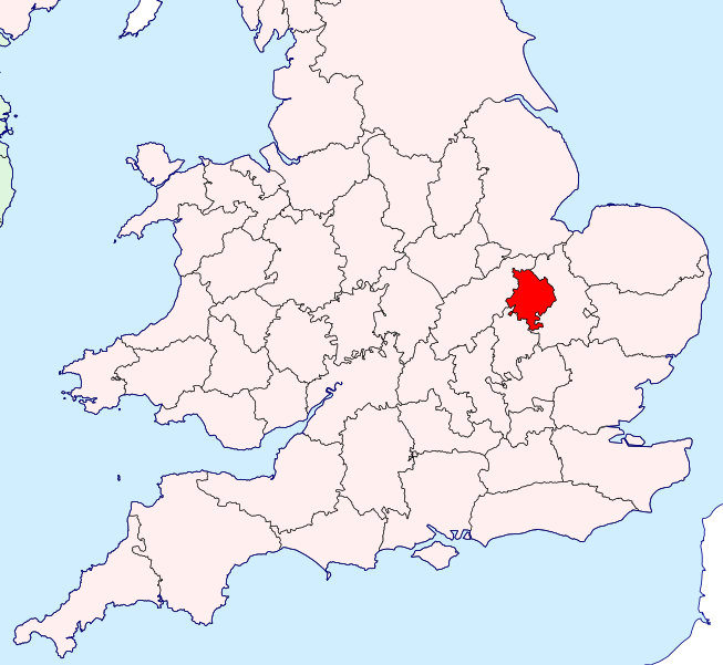
| 11:52, April 5, 2025 | Huntingdonshire Brit Isles Sect 5.svg.png (file) |  |
106 kilobytes | Description: Huntingdonshire location map Source: https://commons.wikimedia.org/wiki/File:Huntingdonshire_Brit_Isles_Sect_5.svg Public domain {{publicdomain}} Category:United Kingdom | 1 |
| 09:08, April 1, 2025 | Derbyshire Brit Isles Sect 3.svg.png (file) |  |
145 kilobytes | Description: Derbyshire location map Source: https://commons.wikimedia.org/wiki/File:Derbyshire_Brit_Isles_Sect_3.svg {{publicdomain}} | 1 |
| 09:05, April 1, 2025 | Derbyshire flag.svg.png (file) |  |
18 kilobytes | Description: Flag of Derbyshire https://commons.wikimedia.org/wiki/File:Derbyshire_flag.svg {{publicdomain}} | 1 |
| 08:59, April 1, 2025 | Flag of Leicestershire.svg.png (file) |  |
13 kilobytes | Description: English: The flag of the historic county of Leicestershire Source: https://commons.wikimedia.org/wiki/File:Flag_of_Leicestershire.svg {{publicdomain}} | 1 |
| 08:56, April 1, 2025 | Leicestershire Brit Isles Sect 5.svg.png (file) |  |
148 kilobytes | Description: Leicestershire location map Source:https://commons.wikimedia.org/wiki/File:Leicestershire_Brit_Isles_Sect_5.svg {{publicdomain}} | 1 |
| 13:34, March 27, 2025 | The Square, Shrewsbury (1).JPG (file) |  |
112 kilobytes | Description: English: The Square, Shrewsbury, UK By Gnesener1900, CC BY 3.0 <https://creativecommons.org/licenses/by/3.0>, via Wikimedia Commons This file is licensed under the [https://creativecommons.org/licenses/by-sa/3.0/deed.en Creative Commons... | 1 |
| 12:34, February 26, 2025 | Lake Windermere, Cumbria - geograph.org.uk - 2057866.jpg (file) |  |
88 kilobytes | English: Lake Windermere, Cumbria Source: https://commons.wikimedia.org/wiki/File:Lake_Windermere,_Cumbria_-_geograph.org.uk_-_2057866.jpg This file is licensed under the [https://creativecommons.org/licenses/by-sa/2.0/deed.en Creative Commons Attrib... | 1 |
| 18:03, February 24, 2025 | Worcestershire Brit Isles Sect 5.svg.png (file) |  |
106 kilobytes | Worcestershire location map Source: https://commons.wikimedia.org/wiki/File:Worcestershire_Brit_Isles_Sect_5.svg Public domain {{public domain}} | 1 |
| 18:01, February 24, 2025 | Flag of Worcestershire.svg.png (file) |  |
21 kilobytes | Flag of Worcestershire Source: https://commons.wikimedia.org/wiki/File:Flag_of_Worcestershire.svg Public domain {{publicdomain}} Category:United Kingdom | 1 |
| 14:12, February 24, 2025 | Middlesex Brit Isles Sect 5.svg (1).png (file) |  |
106 kilobytes | Middlesex location map Source: https://commons.wikimedia.org/wiki/File:Middlesex_Brit_Isles_Sect_5.svg Public domain {{publicdomain}} Category:United Kingdom Category:Maps of Europe | 1 |
| 14:11, February 24, 2025 | Middx Flag.jpg (file) |  |
32 kilobytes | English: Flag of Middlesex Source: https://commons.wikimedia.org/wiki/File:Middx_Flag.jpg Public domain. {{publicdomain}} | 1 |
| 14:02, February 24, 2025 | Essex Brit Isles Sect 5.svg.png (file) |  |
106 kilobytes | Essex location map Source: https://commons.wikimedia.org/wiki/File:Essex_Brit_Isles_Sect_5.svg Public domain {{publicdomain}} Category:United Kingdom Category:Maps of Europe | 1 |
| 14:00, February 24, 2025 | Flag of Essex.svg.png (file) |  |
28 kilobytes | Flag of Essex Source: https://commons.wikimedia.org/wiki/File:Flag_of_Essex.svg Public domain {{publicdomain}} | 1 |
| 12:17, February 24, 2025 | Caernarfonshire Brit Isles Sect 5.svg.png (file) |  |
106 kilobytes | Caernarfonshire location map Source: https://commons.wikimedia.org/wiki/File:Caernarfonshire_Brit_Isles_Sect_5.svg Public domain {{publicdomain}} Category:United Kingdom | 1 |
| 12:15, February 24, 2025 | Flag of Caernarfonshire.svg.png (file) |  |
23 kilobytes | English: Flag of Caernarfonshire Cymraeg: Baner Sir Gaernarfon Source: https://commons.wikimedia.org/wiki/File:Flag_of_Caernarfonshire.svg Public domain {{publicdomain}} Category:United Kingdom | 1 |
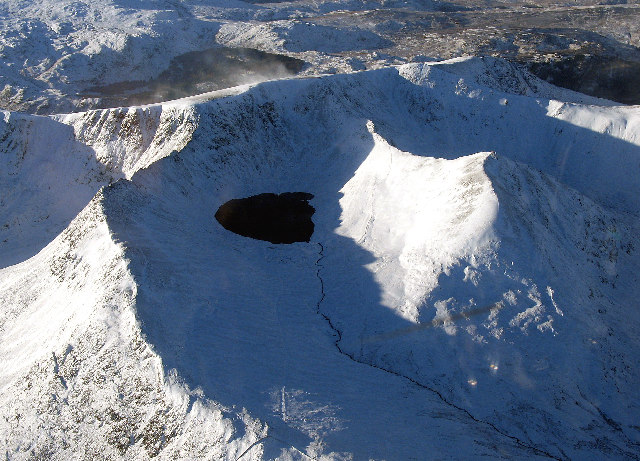
| 11:52, February 24, 2025 | Helvellyn(SimonLedingham)Dec2004.jpg (file) |  |
136 kilobytes | Description: English: Helvellyn, Cumbria, Great Britain - Striding Edge, Red Tarn, Red Tarn Beck, Helvellyn, Swirral Edge and Castye Cam are shown in their winter coat of snow. Source: https://commons.wikimedia.org/wiki/File:Helvellyn(SimonLedingham)D... | 1 |
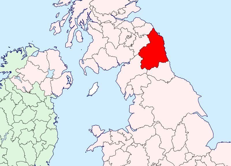
| 11:43, February 24, 2025 | Northumberland Brit Isles Sect 3.svg.png (file) |  |
145 kilobytes | Description: Northumberland location map Source: https://commons.wikimedia.org/wiki/File:Northumberland_Brit_Isles_Sect_3.svg Public domain {{[publicdomain}} Category:English counties | 1 |
| 11:37, February 24, 2025 | East Lothian Brit Isles Sect 2.svg.png (file) |  |
117 kilobytes | Description: East Lothian location map SOurce: https://commons.wikimedia.org/wiki/File:East_Lothian_Brit_Isles_Sect_2.svg Public domain {{publicdomain}} | 1 |
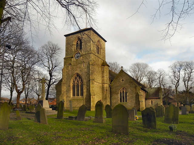
| 11:17, February 24, 2025 | St Thomas, Golborne.jpg (file) |  |
484 kilobytes | Description: English: Photograph of St Thomas' Church, Golborne, Lancashire, England Source: https://commons.wikimedia.org/wiki/File:St_Thomas,_Golborne.jpg This file is licensed under the [https://creativecommons.org/licenses/by-sa/2.0/deed.en Creat... | 1 |
| 16:11, February 23, 2025 | WiganTownHall.jpg (file) |  |
94 kilobytes | Description: English: The former Wigan Town Hall, built in 1866-7. Source: https://commons.wikimedia.org/wiki/File:WiganTownHall.jpg This file is licensed under the [https://creativecommons.org/licenses/by/3.0/deed.en Creative Commons Attribution 3.0... | 1 |